Only in Boston
Which Boston Do You Live In?
Ask a Bostonian where they are from and they will almost never say Boston. They will say Eastie, or Southie, or JP, or Rozzie, or Dot, or Mattapan. That is not a quirk of local slang. It is an accurate description of how this city actually works. Boston is a federation of neighborhoods that happens to share a mayor, and the one you sleep in shapes your school, your bus, your library, and which of the thirteen city councillors is obliged to answer your email.
The nine districts
Nine councillors are elected by district. Four more are elected at large by the whole city, so every Bostonian has five councillors: one of their own, and four they share with everybody. Click your piece of the map and it will take you directly to your councillor.
Boundaries as adopted by the City Council on May 24, 2023, drawn from the city’s own open data.
Nobody agrees how many neighborhoods there are
This is true, and it is worth knowing, because it is a small lesson in how official facts get made. The city’s own website lists twenty-four neighborhoods. The Planning Department’s research division, which produces the population numbers, lists twenty-three, and not the same twenty-three: it splits out Longwood and the South Boston Waterfront, and folds in places the other list separates. Both are the City of Boston. Neither is lying. The boundaries of a neighborhood are a matter of custom, memory and argument, and the city has simply never settled it.
The districts, by contrast, are drawn in law, to the street. That is why this page is organized by district and not by neighborhood.
Your neighborhood is probably split
Here is the part that trips people up. Council districts do not respect neighborhood lines. Dorchester is carved across three districts. So is the South End. Roslindale sits in three. Mattapan, Jamaica Plain, Mission Hill, Roxbury and Fenway are each split in two. Only Allston and Brighton get to be whole.
So “I live in Dorchester, so my councillor is…” is a sentence that ends in a guess. Your street decides. Use the map.
- Split across three districts: Dorchester, the South End, Roslindale.
- Split across two: Mattapan, Jamaica Plain, Mission Hill, Roxbury, Fenway and Kenmore.
- Whole and undivided: Allston and Brighton, which is District 9, and nothing else.
District 1: Charlestown, East Boston and the North End

Three neighborhoods separated by water and joined by a tunnel. East Boston is the landing place: it took in Irish, then Italians, then Central and South Americans, and today it is the most Latino part of the city. It also lives directly under Logan’s flight path, which is why its politics run so hard on noise, air quality and who gets to breathe what.

Your delegation on Beacon Hill
- Adrian C. Madaro · 1st Suffolk district, State House
- Daniel J. Ryan · 2nd Suffolk district, State House
- Lydia Edwards · Third Suffolk district, State Senate
- Sal N. DiDomenico · Middlesex and Suffolk district, State Senate
State districts and council districts are drawn separately, so your exact street decides which of them is yours.
In 1968 a group of East Boston mothers walked into Maverick Street and stood in front of the dump trucks running fill to Logan, and the trucks were rerouted. Forty five years later, on November 5, 2013, this neighborhood voted a billion dollar casino down, 4,281 to 3,353, because the Council had made it an East Boston question and nobody else’s. Twice, the people who live under the flight path decided what happened next.
District 2: Downtown, South Boston, Chinatown and part of the South End

The oldest fault line in Boston runs through this district. South Boston was the center of the resistance to busing in 1974, and it is now one of the fastest gentrifying places in the state. Chinatown, meanwhile, is one of the last surviving Chinatowns in America, and it has spent forty years fighting to not be paved over.

Your delegation on Beacon Hill
- David Biele · 4th Suffolk district, State House
- Aaron Michlewitz · 3rd Suffolk district, State House
- Nick Collins · First Suffolk district, State Senate
State districts and council districts are drawn separately, so your exact street decides which of them is yours.
In 1993 a hospital wanted to put an eight story, 455 car garage on a Chinatown lot known as Parcel C. Residents gathered 2,500 signatures, forced an environmental review, and held their own community vote. It came back 1,692 to 42. The garage was never built, and the fight is why Chinatown still has ground to stand on.
District 3: Most of Dorchester and part of the South End

Dorchester is the biggest neighborhood in Boston by a wide margin, so big that no single councillor represents it: it is split across three districts. If you live in Dorchester, your street decides your councillor, not your neighborhood.
Your delegation on Beacon Hill
- Daniel J. Hunt · 13th Suffolk district, State House
- David Biele · 4th Suffolk district, State House
- John Francis Moran · 9th Suffolk district, State House
- Nick Collins · First Suffolk district, State Senate
State districts and council districts are drawn separately, so your exact street decides which of them is yours.
Dorchester is not a gap in this page, it is the largest neighborhood in the city and it has organized like it. When the city closed the Codman Square library branch, residents voted at a civic association meeting in 1974 to turn the empty building into a health center, then spent four years fighting the city and the state to do it. It opened in 1979 and now handles around 100,000 visits a year. Down at Fields Corner, the Vietnamese American community raised $5.1 million and in 2002 opened VietAID, the first purpose built Vietnamese American community center in the country.
District 4: Mattapan, part of Dorchester, parts of Jamaica Plain and Roslindale

The heart of Black Boston, and home to the largest Haitian community in the state. Worrell ran for Council President in January 2026 and lost by a single vote.

Your delegation on Beacon Hill
- Russell E. Holmes · 6th Suffolk district, State House
- Brandy Fluker-Reid · 12th Suffolk district, State House
- Christopher J. Worrell · 5th Suffolk district, State House
- Liz Miranda · Second Suffolk district, State Senate
- Nick Collins · First Suffolk district, State Senate
State districts and council districts are drawn separately, so your exact street decides which of them is yours.
For decades the commuter rail ran through Mattapan and Dorchester without stopping, carrying suburban riders over the heads of the people who lived underneath it. Neighborhood coalitions spent twenty years demanding stations on their own line, and they won four of them. The last, Blue Hill Avenue, opened on February 25, 2019. A train that would not stop for you now stops for you, because people organized until it did.
District 5: Hyde Park, Readville, parts of Mattapan and Roslindale

The far southern edge, where Boston stops feeling like a city. Cleary Square is its downtown, and the 32 bus is its spine.
Your delegation on Beacon Hill
- Rob Consalvo · 14th Suffolk district, State House
- Brandy Fluker-Reid · 12th Suffolk district, State House
- Michael F. Rush · Norfolk and Suffolk district, State Senate
- Liz Miranda · Second Suffolk district, State Senate
State districts and council districts are drawn separately, so your exact street decides which of them is yours.
In 1985 Roslindale’s merchants and residents built one of the first urban Main Street programs in the country, and it worked so well that Boston copied it citywide in 1995. A neighborhood invented a way to save itself, and the city took the idea.
District 6: Jamaica Plain, West Roxbury, parts of Roslindale, Mission Hill and Roxbury

Jamaica Plain and West Roxbury sit in the same district and do not much resemble each other, which tells you most of what you need to know about how district lines get drawn.
Your delegation on Beacon Hill
- William F. MacGregor · 10th Suffolk district, State House
- Samantha Montaño · 15th Suffolk district, State House
- Michael F. Rush · Norfolk and Suffolk district, State Senate
- Liz Miranda · Second Suffolk district, State Senate
State districts and council districts are drawn separately, so your exact street decides which of them is yours.
They stopped an interstate. Twelve lanes of I-95 were going to be driven through these neighborhoods, and on January 25, 1969, two thousand people filled the State House on what they called People Before Highways Day. In February 1970 the Governor declared a moratorium and the highway was never built. The land it would have paved is now the Orange Line and the fifty two acre Southwest Corridor Park. You can walk the route of a road that people talked the state out of.
District 7: Roxbury, Fenway, parts of Dorchester and the South End
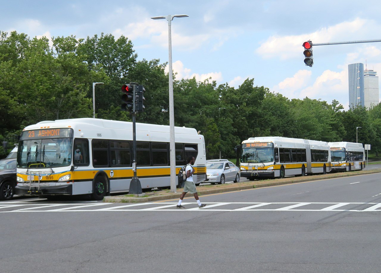
Roxbury is the historic center of Black political power in Boston and the place the 1974 buses ran to and from. This seat was empty for part of 2025: the previous councillor resigned after pleading guilty to federal corruption charges, and Culpepper was sworn in on January 5, 2026.
Your delegation on Beacon Hill
- Chynah Tyler · 7th Suffolk district, State House
- Christopher J. Worrell · 5th Suffolk district, State House
- John Francis Moran · 9th Suffolk district, State House
- Liz Miranda · Second Suffolk district, State Senate
State districts and council districts are drawn separately, so your exact street decides which of them is yours.
This is the story that belongs to Roxbury more than any scandal does. In the 1980s the Dudley Street neighborhood was sitting on roughly 1,300 abandoned lots. Residents founded the Dudley Street Neighborhood Initiative in 1984, wrote their own plan, and got the city to adopt it. Then they asked for something extraordinary. In 1988 their land trust took on a legal status called Chapter 121A, and on November 10, 1989 the Boston Redevelopment Authority board voted unanimously to grant it the power of eminent domain over the 62 acre Dudley Triangle. It is believed to be the only community organization in the United States ever handed that power. Ordinary residents were given a power of government, and they used it: more than thirty acres and 225 permanently affordable homes are still under neighborhood control.
In 2019 the neighborhood renamed Dudley Square to Nubian Square. Notice how. The citywide ballot question lost, while the precincts that actually live here voted overwhelmingly yes. So the campaign went to the body that genuinely decides street and square names, the Public Improvement Commission, and on December 19, 2019 it voted the name through. Knowing which room holds the decision is not a technicality. It is the whole skill.
District 8: Back Bay, Beacon Hill, the West End, parts of Fenway, Kenmore and Mission Hill

The wealthiest district, and the one containing the State House. It also contains the ghost of the West End, an entire working-class neighborhood the city demolished in the 1950s and never rebuilt. Boston learned from that.

Your delegation on Beacon Hill
- Jay D. Livingstone · 8th Suffolk district, State House
- Chynah Tyler · 7th Suffolk district, State House
- William N. Brownsberger · Suffolk and Middlesex district, State Senate
- Lydia Edwards · Third Suffolk district, State Senate
- Liz Miranda · Second Suffolk district, State Senate
State districts and council districts are drawn separately, so your exact street decides which of them is yours.
In 1969 Harvard began sending eviction notices to 182 tenants in Mission Hill, clearing ground for a hospital expansion. The tenants organized as Roxbury Tenants of Harvard, and they did something far harder than saying no: they wrote the alternative themselves, a full housing plan of their own, and they refused to leave until Harvard agreed to pay for it. Harvard leased them the land for a dollar a year. What got built is Mission Park, more than 700 affordable apartments and town homes, finished in 1978. In 2000 the tenants bought the whole thing outright, and they still own it. The towers carry the names of the people who organized. You can walk past them today.
District 9: All of Allston and Brighton

The only district that is not split, and the home of the current Council President. Breadon came to the United States from Northern Ireland in 1995 and is the first openly gay woman to serve on the Council.

Your delegation on Beacon Hill
- Michael J. Moran · 18th Suffolk district, State House
- Kevin G. Honan · 17th Suffolk district, State House
- William N. Brownsberger · Suffolk and Middlesex district, State Senate
State districts and council districts are drawn separately, so your exact street decides which of them is yours.
When urban renewal cleared Barry’s Corner, five congregations came together and built 213 affordable apartments on it. Forty years later the community was negotiating with Harvard over that same land, and it did not simply sell. It traded, on its own terms, for 340 homes and a community center. Allston and Brighton have been bargaining with an institution far richer than they are for two generations, and they have not lost the habit of asking for something back.
Nine of your councillors answer to a district. Four answer to the whole city. All thirteen have a public email address and a phone number.
Photos: “Doucette Square, Dorchester” by Pi.1415926535, CC BY-SA 3.0; “Exposed trolley tracks on Orlean Street in East Boston” by 4300streetcar, CC BY 4.0; “South Boston from the air” by Loodog, CC BY-SA 4.0; “Mattapan Square” by 4300streetcar, CC BY 4.0; “MBTA route 32 bus at Cleary Square” by Pi.1415926535, CC BY-SA 4.0; “Jamaica Pond from Chestnut Street entrance” by Pi.1415926535, CC BY-SA 4.0; “MBTA buses on Tremont Street in Roxbury Crossing” by Pi.1415926535, CC BY-SA 3.0; “Back Bay panorama from Westin Copley” by Pi.1415926535, CC BY-SA 3.0; “View of Brighton, Boston from St Elizabeth’s” by 4300streetcar, CC BY 4.0. Via Wikimedia Commons.